Banks Peninsula is in a recovery period following severe wet weather, flooding and land slips across the district in February 2026.
Sign up for our Banks Peninsula recovery newsletter

The safety and wellbeing of Banks Peninsula residents – and that of anyone visiting Banks Peninsula – remains our top priority.
Our focus is on supporting affected communities, repairing damaged water and roading infrastructure around the district, while keeping a close eye on land conditions as recovery continues.
12 March update
Read our latest update(external link) covering rubbish skips, road closures, Awa-iti Domain, the Heritage Park Little River playground and the Little River Library and Service Centre building.
Support is available if you or your whānau have been affected by the flooding, slips, or disruption caused by the February weather event.
This may include help with immediate needs, advice on insurance and flood-damaged goods, or support for people who are isolated or under pressure.
Council welfare assistance
If you or someone you know needs immediate welfare assistance, please contact our community support team:
- To speak to our staff, phone 03 941 8999 or 0800 800 169.
- If you need emergency assistance, call 111.
- Email us at jeoc.recoverymgr@ccc.govt.nz.
Insurance advice
For insurance advice, contact your insurance provider directly.
For free, independent advice:
- Phone 0508 624 327
- Visit New Zealand Claims Resolution Service(external link)
Health advice
For health advice, check with your GP.
For general information, visit Health NZ(external link).
To help keep people safe, the Local State of Emergency empowers the Council to perform Rapid Building Assessments of buildings that may have been damaged, and put a coloured notice (placard) on it that lets everyone know its status.
Normally, when the Local State of Emergency is lifted, those notices no longer apply. However, designating an area under the Building Act extends their legal force for as long as needed. It’s a simple step that means we can manage the safety of each building over the long-term, as well as any emerging issues.
Red placards
A red placard means a building is unsafe and poses a risk and must not be entered or occupied. If the placard has a dashed black border on it, it means the building is at risk from an external hazard.
Yellow placards
A yellow placard means that access to the building is restricted – some parts of the building can be accessed, and some can’t. If there’s a dashed black border, access to the building is allowed on a short-term basis only, with supervision.
White placards
A white placard means your building can be occupied. However, it doesn’t necessarily mean the building is free of any damage, so keep an eye out for any changes and contact your landlord or rental manager if you rent your home.
You can find more information at the Ministry of Business, Innovation and Employment(external link).
What's next?
We understand that land stability is a significant worry for residents and the community, and we want to reassure you that a lot of work is happening at our end. We have experience in responding to this type of event.
We’ll continue to monitor the land instability across the district to determine if there are any long-term patterns of movement, and what sort of work will be required to make the area safe and stable.
We also understand that many of those affected are looking for clear information and what work will be carried out and when. We’re actively working to provide residents with updates when we have information to share.
Get in touch
If you or someone you know needs immediate welfare assistance, please contact our community support team(external link).
We’re committed to keeping you informed. For updates, contact us(external link) or to speak to our staff, phone 03 941 8999 or 0800 800 169.
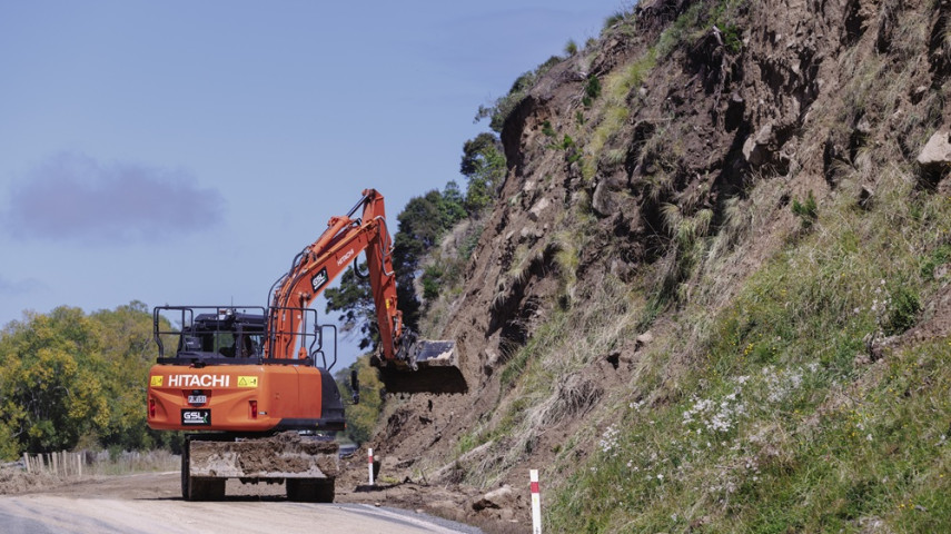
Some areas of Banks Peninsula have been affected by landslips and land instability. We know land instability can feel unsettling and create uncertainty for communities.
Council teams and geotechnical specialists are assessing areas affected by slips and land movement across Banks Peninsula to understand current conditions and help protect road access and public safety.
Private landowners may also choose to seek specialist advice to better understand conditions on their own property.
In some locations, access restrictions or further assessments may be required while this work is underway.
Remediation work is already planned for Akaroa’s Lighthouse Road(external link), following a slip in May 2025. Additional potential remediation work required for a site further along Lighthouse Road following the February 2026 slip is also being investigated.
What to do if you notice land movement
There may be some ongoing movement of land, and you may see cracks in the road surface or surrounding land open – this is to be expected as the land continues to settle. Our contractors will be out and about making repairs. If you see a large or new crack, please call 111.
How land assessments are done
Council teams and geotechnical specialists are assessing areas affected by slips and land movement across Banks Peninsula to understand current conditions and help protect road access and public safety.
Assessments can include site visits, visual inspections, geological mapping and monitoring of land movement. In some locations, specialist equipment or modelling may be used to understand how land could behave under different conditions, such as further heavy rain.
This work helps identify areas that may need further investigation, monitoring or remediation, and informs decisions about access, safety measures, and longer‑term recovery planning.
Land assessments take time, and in some cases, land may continue to settle. We will continue to share updates as more information becomes available.
Slips and land movement on private property
Slips and unstable ground on private property can be dangerous. Please take care and avoid clearing slips or moving material yourself, as ground conditions can change without warning.
Before starting any work, check what rules apply and get the right advice. Some work on private land may require approval to make sure it is safe and compliant.
Who to contact
If you’re unsure what work is allowed or need advice before starting any work on a slip on your property, contact:
- Christchurch City Council – for advice on land instability, safety, and whether approvals may be required.
- Environment Canterbury – for guidance on earthworks and Resource Management Act requirements(external link).
You can contact the Council’s customer services team, who can help direct your enquiry to the right team. Phone: 03 941 8999 or 0800 800 169
Check what rules apply
Before starting any work related to slips or land movement, check what rules apply. Guidance is available to help you understand what’s allowed and when approvals may be needed.
Environment Canterbury(external link) has advice to help you find the right information and make sure any work you do complies with the Resource Management Act.
Most roads across Banks Peninsula are open, and essential services are operating. Council teams continue to monitor conditions and carry out repair and maintenance work where needed to support safe access and reliable infrastructure.
Road updates
Flooding and slips have damaged some roads across Banks Peninsula, resulting in temporary closures and access restrictions in a small number of areas. While most roads are open, some are currently limited to residents.
Crews are assessing damage, completing repairs, and reopening routes where it is safe to do so. Work is prioritised based on safety and access needs, and we understand this can be frustrating.
Road access may change as conditions evolve, particularly following further rain. Please follow signage and closures.
Road status
Updated: Thursday 26 March 2026
We will continue update this page as information comes to hand.
The following roads have restricted access for emergency vehicles and residents only:
- Kaituna Valley Road, from Parkinsons Road to the end
Roads closed:
- Jubilee Road – around 900m up from Wainui Main Road. This is due to a bridge washout.
- Western Valley Road – from #1280 to the saddle. This is due to a dropout and slips.
Advice for visitors and freight
Most roads across Banks Peninsula are open and accessible, and communities and businesses are welcoming visitors. However, some repair work and monitoring continue, and conditions can change, particularly after heavy rain.
Freight operators and visitors are encouraged to plan ahead, check for the latest road updates before travelling, and follow any temporary speed limits, signage or restrictions in place.
Please take care around work sites and be patient where crews are completing repairs. Supporting local businesses helps communities recover.
Water supply
Some local water supplies were affected during the weather event. However, we’ve now restored all services.
Wastewater
Wastewater services across Banks Peninsula are operating, with no current disruption to service.
Residents using septic tanks are encouraged to check that their systems are working properly.
Wastewater overflows
Prolonged or heavy rain can put extra pressure on the wastewater network, particularly in areas affected by flooding. When the ground is saturated, stormwater can enter the wastewater system and, in some cases, lead to overflows.
Wastewater overflows can pose health risks. If you see or smell wastewater, avoid contact and keep children and pets away.
Please report any wastewater overflows or sewer issues to Christchurch City Council so they can be investigated and managed safely.
Contact us(external link) or call us anytime on 03 941 8999 or 0800 800 169.
Flood damage, including silt and debris, remains in some locations. Council crews are working in public areas, and advice is available to help residents clean up safely.
Visit Environment Canterbury(external link) for information about cleaning up flood damage on your property or Health NZ(external link) for information on floods and health.
Silt removal
Flooding has left silt and debris on roads, properties and public spaces in some areas. Council crews and contractors are prioritising clean‑up in public areas, while guidance is available to help residents manage silt on private property safely.
Please take care when handling silt, as it may contain contaminants.
Disposing of flood-damage material
Flood‑damaged material from private property is the responsibility of the property owners to dispose of. Please do not place damaged items or debris on the roadside for Council collection.
Piling material on roadsides creates safety hazards and can slow down roading crews who are focused on repairing and reopening roads. We appreciate everyone’s help in keeping roads clear so recovery work can continue safely and efficiently.
Skips
Skips will be available in Little River until Monday 23 March. These are for the disposal of household and garden waste arising from the flood clean-up.
Dealing with silt and mould
Around flooded homes – whether collecting belongings, inspecting for damage, or cleaning up – it’s important to take steps to protect your health, like wearing protective clothing.
Floodwaters and the silt they leave behind can be contaminated. They may contain sewage, farm run-off, industrial chemicals, and harmful bugs.
As flood silt dries, it can turn into fine dust that becomes airborne. Breathing in this dust can irritate or damage your lungs and airways, worsen asthma and other breathing conditions, and irritate your eyes. For these reasons, all flood silt should be treated as contaminated while it remains on your property.
Flooding and pooled water in a home can also cause mould to grow, which may be a health risk for you and your whānau. Look for visible mould and be aware of any musty smell.
For more health advice about floods and cleaning up a flooded home, visit the Health NZ website(external link).
Check what rules apply
Environment Canterbury(external link) has advice to help you find the right information and make sure any work you do complies with the Resource Management Act.