We’re making roading improvements in parts of five suburban areas in Christchurch to make it safer and easier to get around.
Share this

We’re keen to hear from local people about the small things we could do such as pruning trees or more seating, to the bigger things to make it easier and safer to walk, bike, scooter, get the bus and drive in your neighbourhood.
We’ll be working in parts of five suburban areas in Christchurch. We are going to spend the money on work that will make people feel better about their neighbourhood and allow them to easily get to the places that matter to them.
These areas have been selected because they have the highest number of faults such as potholes, accidents and near misses, and requests for things like more crossings and better lighting. They have also experienced significant damage and disruption, or have more people travelling in these areas due to changes in travel patterns following the earthquakes.
The money for the improvement work comes from the Christchurch Regeneration Acceleration Facility (CRAF). The Government funding package of $40 million is for transport projects in Christchurch. The purpose of the funding is to make a difference for affected communities by improving liveability and support their ongoing regeneration.
- $30 million is to fix suburban roads and improve safety. This is what we are seeking your feedback on.
- $5 million is going towards progressing targeted road safety initiatives across the transport network. These safety initiatives will target transport corridors where collectively 829 crashes have occurred, including nine fatal crashes and 107 serious injury crashes.
- $5 million is going toward the implementation of bus priority measures on key public transport routes in Christchurch
Brougham Street is the northern border for this area, with the Heathcote River providing the boundary on the west, south and east sides.
Three options to receive funding have been compiled based on feedback from the Spreydon-Cashmere and Linwood-Central-Heathcote community boards. A programme of work is being finalised and will get underway soon.
What other work is happening?
We have several projects underway, as well as some in the pipeline that we’ll be consulting on.
- Construction is complete on the first section of the Nor’West Arc cycleway between Cashmere Road and Annex Road.
- Work has started on an upgrade of the Hoon Hay Road/Worsleys Road/Cashmere Road intersection.
- Safety improvements to the entrance to Barrington Mall on Barrington Street are underway.
- A locally led project in Beckenham to trial lower speeds, safe crossing points, and intersection changes is underway. The Beckenham speed review(external link) is the first part of this work.
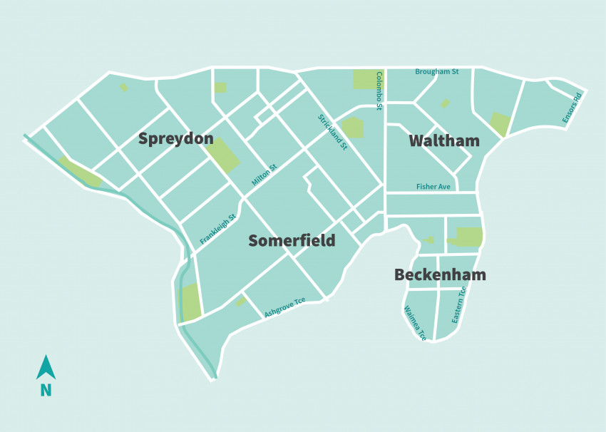
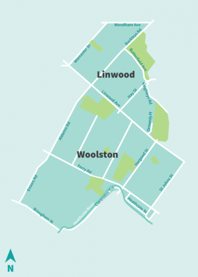
Three options to receive funding have been compiled based on feedback from the community board. This information is being reviewed and further information will be provided to decide the work programme.
What other work is happening?
- We’ve finished upgrading Woolston Village and part of Ferry Road. This makes the village a safer and more attractive place to walk, bike and drive. We renewed underground wastewater pipes at the same time to minimise disruption to the public.
- Work to create a better bus hub on Buckleys Road will begin is underway.
-
Te Pou Toetoe: Linwood Pool is being built on the corner of Linwood Avenue and Smith Street and is due to be finished at the end of the year.
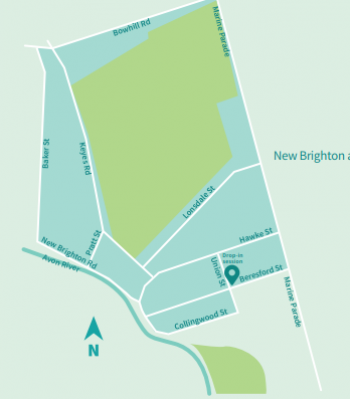
The funding for New Brighton will involve road resurfacing on Marine Parade. There is also potential for resurfacing on Bowhill Road, depending on remaining funding. Road strength assessments have been completed. Results are being analysed and will be presented back to the board with options for suitable treatments.
What other work is happening in New Brighton?
Street upgrade of Marine Parade between Hawke Street and Beresford Street.
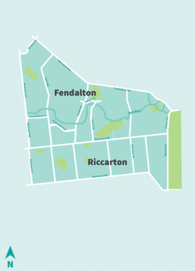
Three options to receive funding have been compiled based on feedback from the Halswell-Hornby-Riccarton and Fendalton-Harewood-Waimairi community boards. This information has been sent to the boards and once feedback has received this will help to decide the work programme.
Other work
We have several projects underway:
- Work is underway on the South Express cycleway through the Riccarton area. The full route runs from Templeton to the central city.
- Construction has started on the Nor'West Arc cycleway connecting Cashmere to Papanui via the University of Canterbury. This route goes along Hansons Lane, Suva Street, Middleton Road and Ilam Road as it passes through Riccarton. This work also includes an upgrade to the Ilam Road/Riccarton Road/Middleton Road intersection.
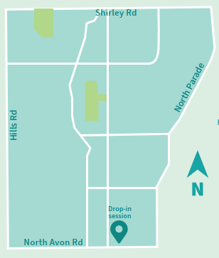
An option to receive funding has been compiled based on feedback from the community board. Feedback on the option has also been sought from the Richmond Residents' and Business Association. A work programme is being developed and will be presented to the community board.
What other work is happening?
We have several streets that are due to be upgraded as well as some, such as Warden Street, that have already been relaid.
What's the plan?
There’s only so much funding to go around, so we need to make sure we’re focusing on the right things. That’s why we need your help.
We’ll be sorting some of the ‘bug bears’ that our residents’ identify, and we plan to get started on the smaller maintenance jobs like fixing potholes and repairing kerbs as quickly as possible.
Work that involves things like changes to the road, cycle lanes or footpaths, or changes to speed limits will take longer. This is because we want to check back in with local communities on the details of what’s proposed before we get approval from community boards or the Council to start construction.
We’ll make sure proposed work is well coordinated with other activities happening or planned in these areas.
Here’s the indicative programme:
- Collate community insights and review against our assessments.
- Work with the local community board to develop a priority list of projects to tackle.
- Let the community know what work is planned, why, where and when.
- Get work underway on smaller jobs.
- Engage with local communities on projects where we’re making changes to the road environment.
- Gain approval from the local community board or the Council.
- Complete detailed design.
- Start construction.
