This bylaw regulates freedom camping activities on Council land in order to balance freedom camping opportunities with limitations that ensure our areas are protected.
For more information on where you can camp, including an interactive map of the areas regulated by the bylaw, see Camping and Campervans in Christchurch and Akaroa(external link).
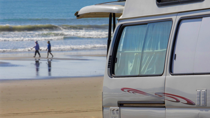
Freedom Camping Bylaw 2021 with maps and descriptions [PDF, 2.7 MB].
The bylaw was amended on 15 November 2023 in response to the requirements of the Self-contained Motor Vehicles Legislation Act 2023, which amended the Freedom Camping Act 2011. This included replacing definitions and text for consistency with the amended Act. The amendments came into force on 22 November 2023.
Schedule 1 to the bylaw describes the prohibited and restricted areas. Schedule 2 to the bylaw contains maps of the prohibited and restricted areas.
Prohibited areas
| Prohibited area | Description of prohibited area |
|---|---|
| Central City(external link) Prohibited Area(external link) |
Christchurch Central City – all Council-owned and/or -managed land between and inclusive of |
| New Brighton Prohibited Area(external link) |
New Brighton North Ramp and South Ramp Off-street car parks – all Council-owned and/or -managed land off-street car parks, immediately north and south of the New Brighton Pier. |
| North Beach Car Park Prohibited Area(external link) |
The car park area alongside Marine Parade, between the North Beach Surf Lifesaving Club and the North New Brighton Community Centre. Applies at weekends, from 7pm Fridays until 7pm Sundays, and between 1 October and 1 May each year. |
| Southshore Spit Prohibited Area(external link) |
All Council-owned and/or managed land in the area between the eastern coastline of the city and south of Caspian Street (including both sides of Caspian Street) to the foreshore of Southshore Spit Reserve. |
| Rāpaki Prohibited Area(external link) |
Rāpaki Settlement – all Council owned and managed land beside and between Governors Bay Road and the foreshore at Rāpaki Jetty. |
| Naval Point Prohibited Area(external link) |
All Council-owned and/or managed land in the Naval Point area is prohibited to freedom camping (other than in the sign-posted area where certified self-contained vehicles can camp for up to two nights in any 30-day period) |
| Lyttelton Prohibited Area(external link) |
Lyttelton Main Business Area – Council owned and/or -managed land between and inclusive of London Street, Oxford Street, Norwich Quay, and Dublin Street. |
| Birdlings Flat Prohibited Area(external link) | Birdlings Flat residential zone – all Council-owned and/or -managed land. The residential zone within the Birdlings Flat settlement area, from 107 Poranui Beach Road, Hill View Rd, Forest View Road, Lake Terrace Road, Clifton St and Coates Roads to the foreshore of Burlington Bay |
| Ōnawe Flat Road Prohibited Area(external link) | Ōnawe Flat Road – all Council-owned and/or -managed land including Ōnawe Point and all areas of Ōnawe Flat Road, up to but excluding the Duvauchelle settlement. |
| Takamatua Prohibited Area(external link) |
Takamatua – all Council-owned and/or -managed land including the road and coastline along Takamatua Bay Road to its intersection with McRae’s Road and including McRae’s Road; and the hillside residential area including Bellbird Lane, Quail Crescent, Kingfisher Road, Fantail Lane, Kōtare Lane, and Lushingtons Bay Road, as shown on the map. |
| French Farm Prohibited Area(external link) |
French Farm – All Council-owned and/or -managed land including the roads and foreshore. |
| Wainui Prohibited Area(external link) |
Wainui – including Stanbury Park. All Council-owned and/or -managed land, including the roads and foreshore. |
| Akaroa Prohibited Area(external link) |
Akaroa Prohibited Area – All Council-owned and/or managed land in Akaroa township is prohibited to freedom camping (other than in the marked parking spaces in the Akaroa Freedom Camping Area, where certified self-contained vehicles can camp for up to two nights in any 30-day period). The Akaroa prohibited area includes:
|
| Ōnuku Prohibited Area(external link) |
Ōnuku – All Council-owned and/or -managed land including the roads and foreshore within the Ōnuku settlement area. |
| Purau Prohibited Area(external link) | Purau – All Council-owned and/or -managed land along the foreshore of Purau Bay. |
| Koukourarata / Port Levy Prohibited Area(external link) | Koukourarata / Port Levy settlement – All Council-owned and/or -managed land within the Koukourarata/Port Levy settlement area. |
| Addington Park Car Park Prohibited Area(external link) | Addington Park Car Park – No written description. Please see map. |
| Lower Styx Rivermouth Prohibited Area(external link) | Lower Styx River mouth – No written description. Please see map. |
| Windsport Park Prohibited Area(external link) | All of the land at Windsport Park near Humphrey’s Drive, including Windsurfers Reserve, Woolston/Ferrymead (as shown on the map) |
Restricted areas
| Restricted area | Description of restricted area |
|---|---|
| Christchurch Urban Restricted Area(external link) |
Christchurch City – all Council-owned and/or -managed land in the greater City urban areas, including Lyttleton, Cass Bay, Corsair Bay, Rāpaki and Governors Bay, excluding and bounded by prohibited areas. |
| City Coastal Restricted Zone(external link) |
City Coastal Restricted Zone - All Council-owned and/or -managed land along the eastern coastline of the city, including part of North New Brighton, all of New Brighton, all of South New Brighton, and ending to the north of Southshore. That is, the area bounded by and including Larnach Street in the north (including Sandholm Close), west along Beach Road to Bower Avenue, down Bower Avenue, and then from the Wainoni Road Bridge on New Brighton Road along the eastern side of the Ōtakaro Avon River and the Avon-Heathcote Estuary / Te Ihutai to South New Brighton, and ending immediately adjacent to the north side of Caspian Street, then following the eastern coastline back up to Marine Parade and Beach Road corner, as shown on the map. |
| Akaroa Freedom Camping Area (restricted area)(external link) | Akaroa Freedom Camping Area is located at the northern end of Akaroa, south of Woodills Road / State Highway 75, and in the north eastern part of Akaroa Boat Park. There are two rows of freedom camping parking spaces to the west of the Akaroa Croquet Club (one row with seven larger parks, and one row with eight medium parks). A third row of freedom camping parking spaces is located alongside the northern fork of Grehan Stream (with three medium parks). Freedom camping parking spaces are clearly marked on-site. |
| Naval Point Freedom Camping Area (restricted area)(external link) |
Naval Point Freedom Camping Area is signposted on site, and is located to the north of the access road that continues on from Charlotte Jane Quay. |
| Governor’s Bay Restricted Area(external link) | Governor’s Bay residential zone – No written description. Please see map. |
| Diamond Harbour Restricted Area(external link) |
Diamond Harbour – All Council-owned and/or -managed land within the Diamond Harbour area, excluding the prohibited area in Purau Bay. |
| Purau Restricted Area(external link) | Purau residential area – No written description. Please see map. |
| Little River Restricted Area(external link) |
Little River settlement – No written description. Please see map. |
| Takamatua Restricted Area(external link) |
Takamatua residential zone – All Council-owned and/or -managed land within the Takamatua settlement area on the flat, including a portion of Takamatua Bay Road and Old French Farm Road. |
| Duvauchelle Restricted Area(external link) |
Duvauchelle settlement – No written description. Please see map. |
| Robinson’s Bay Restricted Area(external link) |
Robinson’s Bay – All Council-owned and/or -managed land within the Robinson’s Bay area. Please see map. |
There are three ways to access the maps.
An interactive map can be found on our camping page.
The maps can be accessed by clicking on the links in the table above(external link), or a complete copy of the Schedule 2 maps can be viewed by downloading the Freedom Camping Bylaw 2021 with maps and descriptions [PDF, 2.7 MB].
Related news
Consultation opens on Freedom Camping Bylaw review
Christchurch City Council is calling for public feedback on proposed changes to the Freedom Camping Bylaw.
17 May 2021
Christchurch’s freedom camping rules could change
Freedom camping along a popular part of Christchurch’s coastline will become more restricted under proposed changes to the city’s Freedom Camping Bylaw.
22 Apr 2021
North Beach Carpark freedom camping ban extended
The temporary weekend ban on freedom camping at the busy North Beach Carpark has been extended.
22 Dec 2020