Adaptation planning is about preparing now for the effects of coastal hazards on our communities, infrastructure, and environment, so that we're ready for what may happen in the future.
Climate change is bringing rising seas, more intense storms, and other changes to our coast. We’re preparing now so that our communities, environment and infrastructure are ready for the future.
We use a flexible approach to help us respond to change over time - even when there’s uncertainty about exactly how or when things will happen.
We follow the Dynamic Adaptive Policy Pathways (DAPP) method, which helps us stay flexible over time. It’s like having a roadmap with different routes - depending on how things unfold, we can adjust our course.
We’re generally following the approach recommended by the Ministry for the Environment (MfE) in the 2024 Coastal Hazards and Climate Change Guidance for Local Government(external link), and modifying it where appropriate for Ōtautahi Christchurch's conditions.
For a summary of the MfE recommended process and Dynamic Adaptive Policy Pathways (DAPP), read our fact sheet [PDF, 577 KB].
Our planning approach is guided by the Council’s Coastal Adaptation Framework [PDF, 4.7 MB], which sets out roles and responsibilities, guiding principles, and how we work with rūnanga and communities to explore risks and solutions together.
We’re working alongside local communities, rūnanga and partners to:
- Understand local values
- Consider and assess hazards and risks
- Consider all options for adapting to the risks and determine preferred ways forward
This approach helps us make decisions that are grounded in local knowledge and values, and that keep options open for the future.
There are different ways we can respond to coastal hazards. Often, the best approach will use a mix of options depending on the situation.
Our catalogue of coastal hazard adaptation options [PDF, 3.2 MB] sets out these options in more detail, but the main types are:
- No action – letting natural processes occur without intervention, where there are no major risks to public assets.
- Maintain – keeping existing defences and assets safe while recognising that the coastline will change over time.
- Protect – defending land and assets from erosion and flooding using things like sea walls, planting dunes, or beach nourishment.
- Accommodate – continuing to live with hazards by adapting how we build and manage land, e.g. raising floor levels or managing water.
- Retreat – moving people or assets away from high-risk areas, leaving the coast to respond to natural processes.
For a quick overview, read our summary of the catalogue [PDF, 1.5 MB].
A change to the Christchurch District Plan is being considered to respond to the coastal flooding and erosion that will get worse as the climate changes, and which will increasingly threaten existing infrastructure, public access, private property and other coastal values.
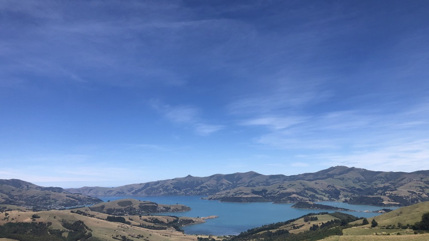
On 4 March 2025 the Council adopted the Coastal Hazards Adaptation Plan for Whakaraupō Lyttelton Harbour and Koukourarata Port Levy. This is the first adaptation plan agreed across the district.
The Climate Hazards Adaptation Planning team is now working on developing a rationale for where adaptation planning should be undertaken next and is planning to take this information to the Council for a decision in early 2026.
A collaborative agency approach is fundamental to the success of this work programme.
A significant partner for the Council in this work is Te Rūnanga o Ngāi Tahu and the six Papatipu Rūnanga, given the intrinsic values that Māori hold with whenua, wai and the environment. Representatives of Ngāi Tahu and Papatipu Rūnanga also participate in the Coastal Hazards Working Group, a governance group of the Coastal Hazards Adaptation Planning programme.
Alignment with coastal environment planning work led by Environment Canterbury is also critical. Two representatives of Environment Canterbury have joined the Coastal Hazards Working Group, and the organisation has provided significant staff input to support the development of the first Adaptation Plan.
Council also works closely with the University of Canterbury, who provide a wide range of support to the programme, from research and technical expertise to community initiatives and student involvement.
- Management Framework [PDF, 3 MB] – An overview of the legislative and policy context for the Coastal Hazard Adaptation Planning Programme and Coastal Hazards District Plan Change.
- Canterbury Regional Policy Statement – 2013(external link), Environment Canterbury.
- New Zealand Coastal Policy Statement –2010(external link), Department of Conservation.
- Ngāi Tahu Climate Change Strategy – 2018(external link), Te Rūnanga o Ngāi Tahu.
- Resource Management Act – 1991(external link).