Huritini/Halswell River Draft Stormwater Management Plan

We want to know your thoughts on the draft Huritini/Halswell River Stormwater Management Plan.

Project status: Closed for feedback
Open for feedback: 5 July 2021 to 30 August 2021

Share this

Consultation has now closed

Consultation on the Huritini/Halswell River Draft Stormwater Management Plan has now closed. People were able to provide feedback from 5 July to 30 August 2021.

During this time we heard from 12 individuals and groups. You can read their feedback [PDF, 312 KB] and also find out how this influenced the Council decision once the meeting minutes have been released.

Council approved this report on 9 December 2021. You can read the minutes from this meeting here.(external link) 


 This draft Stormwater Management Plan sets out what we need to do in order to meet the conditions of the Comprehensive Stormwater Network Discharge Consent (CSNDC).

The catchment of the Huritini/Halswell River spans most of the western fringe of the city, from the intersection of Chattertons and Langdales roads north of Templeton, to Old Tai Tapu Road, where the river leaves the city boundary. This area is 3,800 hectares.

The catchment has a varied and sensitive water environment, characterised by the temporary upper reaches of tributaries and a number of built drains, natural springs and ponding areas. The area includes Nottingham and Knights streams, and the suburbs of Wigram, Halswell, Cashmere and Hornby.

The main issues for this draft stormwater management plan are the water quality and ecological health of the waterways as they are affected significantly by rural and urban land use.

The limited capacity of the Huritini/Halswell River system also means the Halswell District Drainage Scheme relies on temporarily storing surface water on low-lying agricultural land. This ponded water drains slowly, and this could be made worse if urban runoff increases.

Purpose

The Huritini/Halswell River Draft Stormwater Management Plan has three key purposes:

  1. To meet the targets for lowering stormwater contaminants under the CSNDC
  2. To propose extra targets for lowering stormwater contaminants above and beyond the CSNDC
  3. To describe the ways stormwater discharges will be improved over time to meet environmental objectives. 

Summary document   [PDF, 3.7 MB]

The full Huritini/Halswell River Draft Stormwater Management Plan [PDF, 4.1 MB]

Cultural impact assessment  [PDF, 3.2 MB]

The main issues

Water quality and ecological health

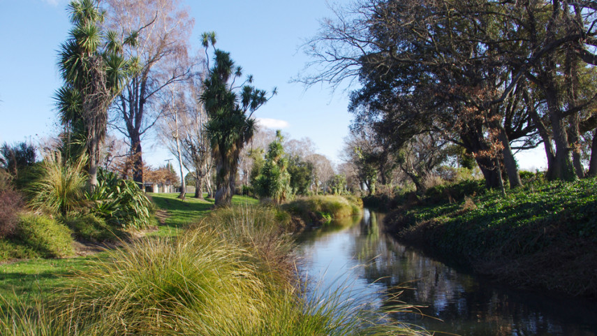
All waterways in the Huritini/Halswell River catchment are affected significantly by rural and urban land use, including the depletion of groundwater. The catchment’s aquatic life is similar to that of other modified lowland streams in Canterbury and New Zealand, and its streams generally have low ecological value. However, two sites in the Quaifes Road spring-fed drain network were assessed as having high ecological values compared to other waterways in the catchment.

Te Waihora/Lake Ellesmere is the receiving environment for the Huritini/Halswell River catchment. It is recognised as a wetland of international significance under a National Water Conservation Order and also supports a commercial eel fishery. The fact the lake is only occasionally opened to the sea increases its vulnerability to a build-up of a range of contaminants.

 The Halswell District Drainage Scheme

The limited capacity of the Huritini/Halswell River system means the Halswell District Drainage Scheme relies on temporarily storing surface water on low-lying agricultural land. This ponded water drains slowly, and this could be made worse if urban runoff increases.

Tangata whenua and cultural values

Values

Water is a taonga (a treasured natural resource) and represents the lifeblood of the environment for tangata whenua. A relationship with the environment is central to Maori creation stories, spiritual belief, and ways to manage resources.

Land, water and resources are a statement of identity. In a particular area, they relate to a group’s origin, history and tribal relationships.

The whakapapa of a waterway would determine its use in tohunga (spiritual), waiwhakaheketupapaku (burial sites), waitohi (spiritual use), waimataitai (coastal mix of fresh and salt water, estuaries), waiora (spiritual healing water), and mahinga kai (food gathering). 


The maintenance of water quality and quantity is perhaps the greatest resource management issue for tangata whenua. All waterways are a major feature within the landscape and should remain as a feature. Culturally, all waterways are significant and come together as one. Waterways begin as rain drops and connect together as streams, lakes, estuaries, and wetlands, all leading to the sea.

 Te Waihora

When tangata whenua first came to Te Waihora/Lake Ellesmere the lake waters extended back toward Motukarara, Irwell and Leeston, covering nearly twice the present-day lake area. 

The outer margin of the lake was also much larger – a vast swampland complex of tall raupo, flax/harakeke, toetoe, sedges/mania and rushes, interspersed with higher, drier strips of land where tussock grasses, tutu and bracken fern grew. There were a large number of settlements and mahinga kai (food gathering) sites along the spit.

Most mahinga kai in and around the lake included patiki (flounder), tuna (eels), aua (yellow-eyed mullet), inanga (whitebait), pingao (sand sedge), harakeke (flax) and paru (mud for dyeing), brown teal (pukeko/pakura), and paradise shelducks (putakitak).

Today, Lake Ellesmere/Te Waihora remains a mahinga kai of great importance to Ngāi Tahu.  Of all the resources gathered from Lake Ellesmere/Te Waihora the fish are most valued.  These resources are considered taonga (treasured for food and cultural identity), because they have supported life and an industry for the area and those who have lived there.

For Ngāi Tahu today, participation in mahinga kai activities is an important part of their cultural identity. This participation relies on access to mahinga kai sites, resources and a healthy environment.

Controlling the contaminants

What we know about sediment

  • Hillside earthworks are a major source
  • Construction is a major source
  • Cuttings and banks (road cuttings, old quarries, private sections) are a significant source
  • Stormwater discharges to hillsides and hill waterways are a significant source
  • Deposits from the atmosphere are a moderate source
  • Road wear and vehicle tyres are a moderate source
  • Stream-bank erosion is a significant source in hill waterways
  • Rural Port Hills erosion contributes to some extent.

What we know about copper

  • Vehicle brake-pads are a major source of copper
  • Copper in rainfall contributes
  • Soils are a minor to moderate contributor
  • Small changes in the number of copper roofs can affect copper concentrations in stormwater
  • Products used to clean roofs and pathways may contribute.

What we know about zinc

  • Roofs are the source of maybe 65-70%+
  • Tyres are the source of maybe 25-30%
  • Other zinc-coated steel items (fences, ventilation ducts, poles) may produce 1 to 5%
  • House & garden products (moss control) (some contribution).
  • Soil contributes to a small extent.

Goal one - Control sediment discharges

Our goals are:

1.1       To ensure the quality of stormwater from all new development sites or re-development sites is treated to best practice.

1.2       To have 100 per cent of stormwater treatment facilities built and operating to Waterways and Wetlands Design Guidelines standards.

1.3       To have less than 5 per cent of all consented construction activities on the flat reported non-compliant due to sediment discharges – by 2025.

1.4       To have less than 10 per cent of all consented construction activities on the Port Hills reported non-compliant due to sediment discharges – by 2025.

1.5       To investigate ways to reduce the environmental effects of sediment discharges – by 2022.

1.6       To look at options for carrying out street sweeping, sump cleaning, and send-to-wastewater trials – in 2020/21.

Recommended for the Surface Water Strategic Plan

1.7       Plant severely eroding natural areas of the Port Hills (approximately 600 hectares) from Ōpāwaho/Heathcote Valley to Hoon Hay Valley.

1.8       Work with farmers to control sediment from erosion sites on Port Hills farms, with subsidies as needed to speed up controls – by 2030.

1.9       Put in place best-practice sediment controls on Port Hills roads and tracks – by 2025.

1.10    Reduce road sediment by the best practicable option determined by the results of street sweeping, sump cleaning and trialing alternative treatments.

Goal two - Control zinc contaminants

Our goals are:

2.1     To have 100 per cent of stormwater treatment facilities constructed and conforming to Waterways and Wetlands Design Guidelines standards.

2.2     To investigate zinc mitigation measures and carry out cost/benefit analyses toward identifying their effectiveness as best practicable options – by 2022.

2.3     To consult with key stakeholders and identify a long-term zinc strategy in line with current technologies – by 2025.

2.4     To collaborate with local and regional government in a joint submission to central government seeking national measures and industry standards to reduce the discharge of contaminants from buildings and vehicles.

Recommended for the Surface Water Strategic Plan

2.5     By 2025, install a large-scale facility (or an array of devices, such as rain gardens) in at least one urban sub-catchment, to treat runoff from busy roads. By 2029, install similar facilities/devices in at least three urban sub-catchments

2.6     Adopt a strategy to limit zinc, based on finding the best practicable options.

2.7     Research and trial ways of trapping roof-sourced zinc on-site.

Goal three - Control copper contaminants

Our goals are:

3.1     To consult with the Government, through the Ministry for the Environment, about legislation to limit the copper content in vehicle brake pads.

3.2     To not permit stormwater discharges into the network from unprotected copper building cladding, spouting or downpipes.

3.3        To investigate a District Plan rule to discourage the use of copper building claddings.

Goal four - Control industrial site contaminants

Our goals are

4.1       To compile a database of industrial sites considered to be medium or high risk based on the best available information – by 2025

4.2       To audit high-risk industrial sites by the approved procedure under the Comprehensive Stormwater Network Discharge Consent.

Goal five - Engagement and education

Our goals are:

5.1       To work with community groups to educate participants about current stormwater practice and to enable the public to take action to stop contaminants at source – by 2025.

5.2       To engage regularly with the Ministry for the Environment to collaborate on initiatives to reduce contaminants – by 2025.

Goal six - Manage Flooding

Our goals are

6.1       To limit the quantity of stormwater from all new development sites to pre-development levels, and minimise stormwater increases from re-development sites through consent conditions.

6.2       To protect houses from flooding during and after development by having controls on new floor levels.

Come talk to us

Day: Thursday 29 July

Location: Te Hāpua Service Centre, Piharau Room

Time: 4.30 to 6.30pm

Share this

Who to contact

Gina Ryan,
Engagement Advisor

How the decision is made

  • Closed for feedback

Takiuru ki ā mātou ratonga
Log in to our services