An applicant has asked the Council, as landowner, to allow formation of a driveway and associated landscaping over unformed legal road from Aston Drive to 9021 Rothesay Road.
Project status: Decision made
Open for feedback: 18 August 2017 to 8 September 2017
Share this
Consultation has now closed
Consultation on an application for formed access to 9021 Rothesay Road has now closed. People were able to provide feedback from Friday 18 August 2017 to Friday 8 September 2017.
During this time we heard from 104 submitters. You can read their feedback [PDF, 604 KB].
Background
An applicant has asked the Council, as landowner, to allow formation of a driveway and associated landscaping over unformed legal road from Aston Drive to 9021 Rothesay Road in Waimairi Beach. The unformed road from Aston Drive to the track known as Whiskey Road is a 20m wide grassed area with a gravel footpath leading to the beach.
The applicant has separately applied for resource consent. The Environment Court has directed that the applicant must find out whether the Council as owner of the unformed road will allow the driveway and planting, before the resource consent for the development of 9021 Rothesay Road can be progressed.
We are seeking feedback from the community regarding this proposal, including which is their preferred option, to assist the Council with their decision.
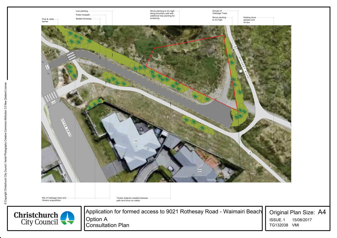
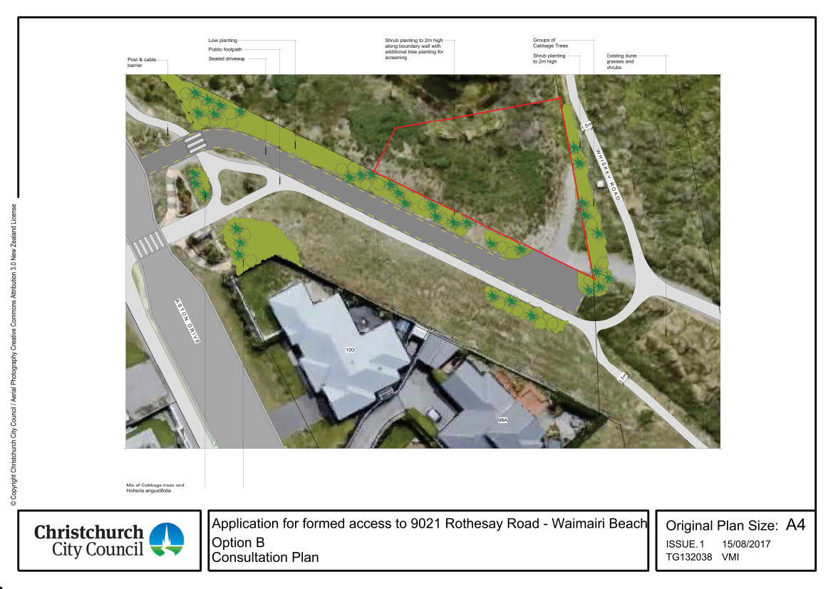
Proposal
Two options have been proposed with both options planning (please note the proposed road signs and markings are indicative only and subject to a separate decision making process):
- A 3.5 metre wide sealed driveway in the same location
- A realigned section of the gravel walking track (note: location differs in each option)
- A sign reading “Emergency and ranger vehicles only” and “No parking” installed at the Aston Drive end of the driveway
- Strips of planting along the northern boundary of the road and the western side of Whiskey Road along the boundary with 9021 Rothesay Road
Option A includes:
- Realignment of the walking track with a grass verge separating it from the driveway
- Bollards along the southern side of the driveway to discourage informal parking
- Curb at the end of the driveway to discourage vehicles entering the coastal area
- Island of planting in the centre of the road reserve near Aston Drive intersection
- Small area of planting adjacent to the northwest boundary of 100 Aston Drive
 [JPG, 155 KB]
Option A
Option B includes:
- Realignment of the walking track directly adjoining the driveway
- Larger area of planting to the northwest of 100 Aston Drive
 [JPG, 146 KB]
Option B
Application documents
Rothesay Road access and planting application [PDF, 8.6 MB]
Rothesay Road access and planting application - Executive Summary [PDF, 164 KB]