Marshland, Spencerville & Kainga area speed management plan

We’re working with the Police and NZTA to find ways to make the roads safer in this area. This includes lowering a number of existing 80 km/h and 70 km/h speed limits to 60 km/h.

Project status: Decision made
Open for feedback: 4 June 2019 to 2 July 2019

Share this

March 2020 

Plan showing remaining section of proposal [PDF, 1.2 MB]


September  2019

At their meeting on 12 September 2019, the Council decided to approve the Papanui-Innes Community Board recommendations for the Marshland, Spencerville and Kainga Area Speed Management Plan.

Community Board members took time to consider and discuss the community feedback on the plan before making their recommendation. Councillors also took the time to consider the feedback in their decision to approve the recommendation. The decision was to:

  • Support the staff preferred option, excluding the section of Marshland Road from a point 250 metres south of its intersection with Main North Road/Spencerville Road to Prestons Road.
  • Vote on the excluded section of Marshland Road following a report back from staff within a three-month period relating to information on safety improvements and funding, as discussed in the joint Papanui-Innes and Coastal-Burwood Community Board meeting of 9 August 2019.

Next steps

The new speed limits will come into force once the necessary signs and markings are in place. The size of the project area means installation of signs and markings may need to happen in stages, but we expect all work to be complete by the end of February 2020.

The staff report back to the Community Boards on the section of Marshland Road currently retained at the existing 70km/h speed limit is likely to be in late December 2019 or February 2020, as the Boards do not meet in January.


July 2019

Consultation on the Marshland, Spencerville and Kainga Speed Management Plan has closed.

256 individuals and groups gave us their feedback. 

Feedback on the proposal [PDF, 1.6 MB]

Summary of feedback [PDF, 252 KB]

Key issues - project team response [PDF, 16 KB]

Option 1 (Preferred Option) [PDF, 2.2 MB]

Option 2 [PDF, 2.2 MB]


The area extends along key routes such as Marshland/Main North Road from south of Queen Elizabeth II Drive to north of the Waimakariri bridge, Spencerville Road and Kainga Road, and includes the local road network west of Marshland Road. 

Why have a speed management plan?  

Slowing down saves lives, with a strong link between speed and safety on our roads.

We want to make Christchurch roads as safe as possible  so we are proposing this speed management plan because there are concerns the current speed limits are not safe or appropriate.

Having speed limits set at the correct level for the conditions is one of the  most important ways we can help people get to where they need to go safely.

""

What needs to be done

  • Consistent, safe and appropriate speed limits.
  • Intersection signs such as ‘Give Way’ and ‘Stop’.
  • More road markings and centre line reflectors. 

Why do we need a speed management plan in this area?

 Marshland, Spencerville, Kainga and Mairehau Roads have all been identified as high risk with unacceptable crash records.

Many other roads in the area have speed limits that are higher than identified safe and appropriate speeds for those roads. 

 Across the whole area there have been four fatal, 28 serious, 77 minor and 155 non–injury crashes between 2013 and 2017.

We have also had requests from the community for lower speeds on local roads west of Marshland, and feedback calling for more consistency in speed limits around the Prestons subdivision.

Looking ahead, we need to consider how speed limits in the area work with the new intersection and road improvements planned for Mairehau Road, and completion of the Christchurch Northern  Corridor (CNC) which will be the quicker, safer north/south route.

Overview Plan

This map can also be viewed in fullscreen mode(external link). Use the back button in your browser to return to this page.


Other ways we can help manage speed in this area

Frequently asked questions

How does this proposal fit in with the timing and purpose of the CNC?

The northern corridor project is planned for completion in October 2020. There will be less traffic on Marshland Road and other roads in the area, but a continuing need to address the safety and speed-related issues on these roads.

Could there be a higher speed limit  on  Marshland Road outside peak hours?

Variable speed limits are only for specific circumstances and need NZTA approval. A variable speed limit would also be difficult and expensive to install and enforce, and would not meet community requests for consistency.

Has crash data been analysed to find out  the main causes and whether intersection improvements might be more appropriate?

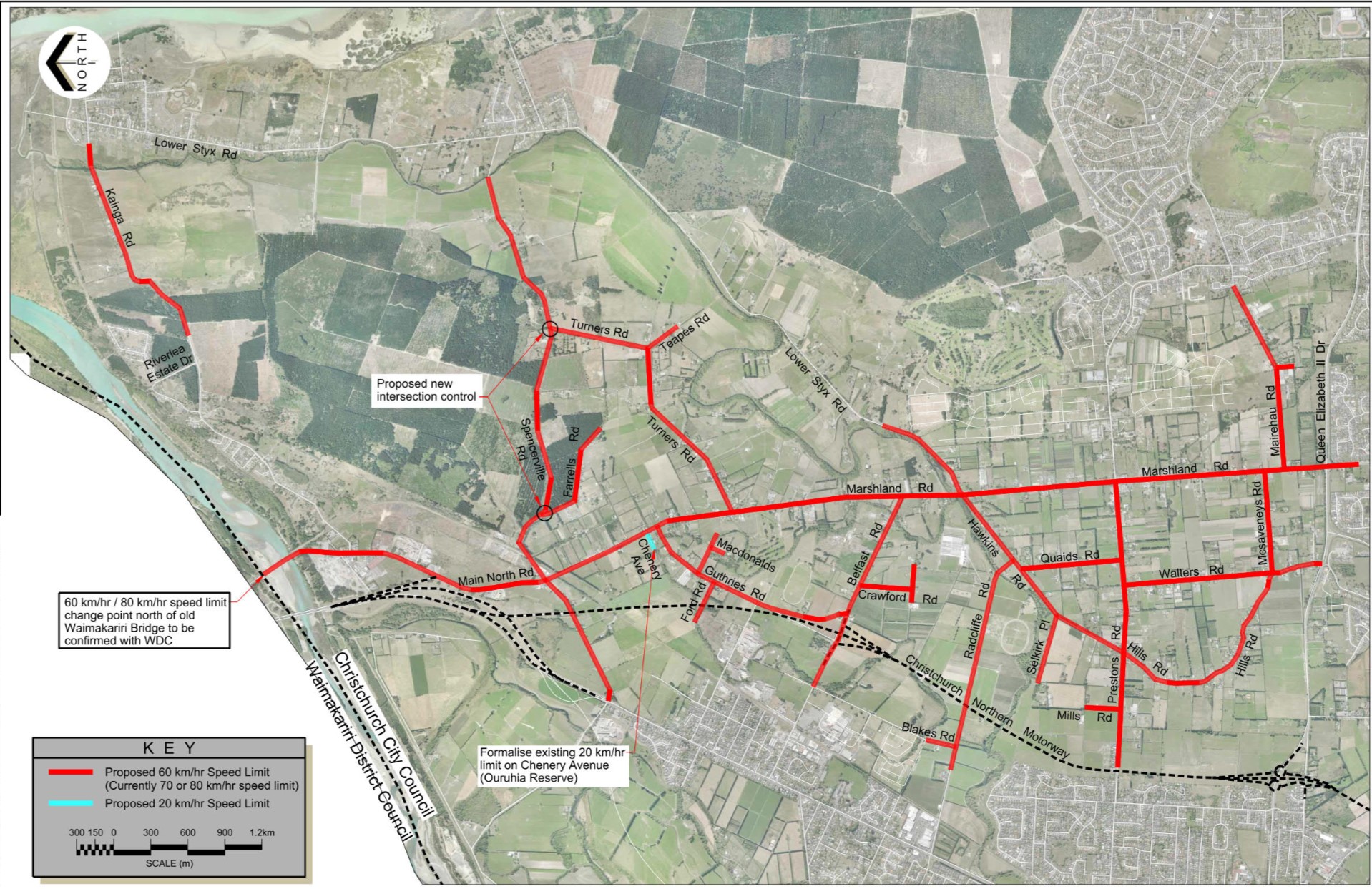
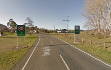
The most frequent types of crash  are ‘loss of control’, ‘cornering’, and ‘rear end’ - all of which suggest speed is a significant contributing factor. This project includes improved controls at the Spencerville/Turners and Spencerville/Farrells intersections.

Council is also planning traffic signals at the Hawkins/Lower Styx/Marshland intersection, and  more signs have been added to  the Hills/Prestons intersection to address safety concerns.

There is funding in our Long Term Plan to investigate  safety improvements at the Belfast/Marshland intersection.


Setting speed limits

The Christchurch City Council's Traffic and Parking Bylaw 2017 allows Council to set and change speed limits on roads within Christchurch in accordance with the Speed Management guide(external link) and the Land Transport Rule: Setting of Speed Limits 2017(external link). Consultation is required as part of this process.

You may also be interested in these supporting documents - Safer Journeys (New Zealand Road Safety Strategy 2010 - 2020)(external link), and the Ministry of Transport's Speed Crash Facts(external link)

Share this

Who to contact

How the decision is made

  • Decision made

Takiuru ki ā mātou ratonga
Log in to our services